


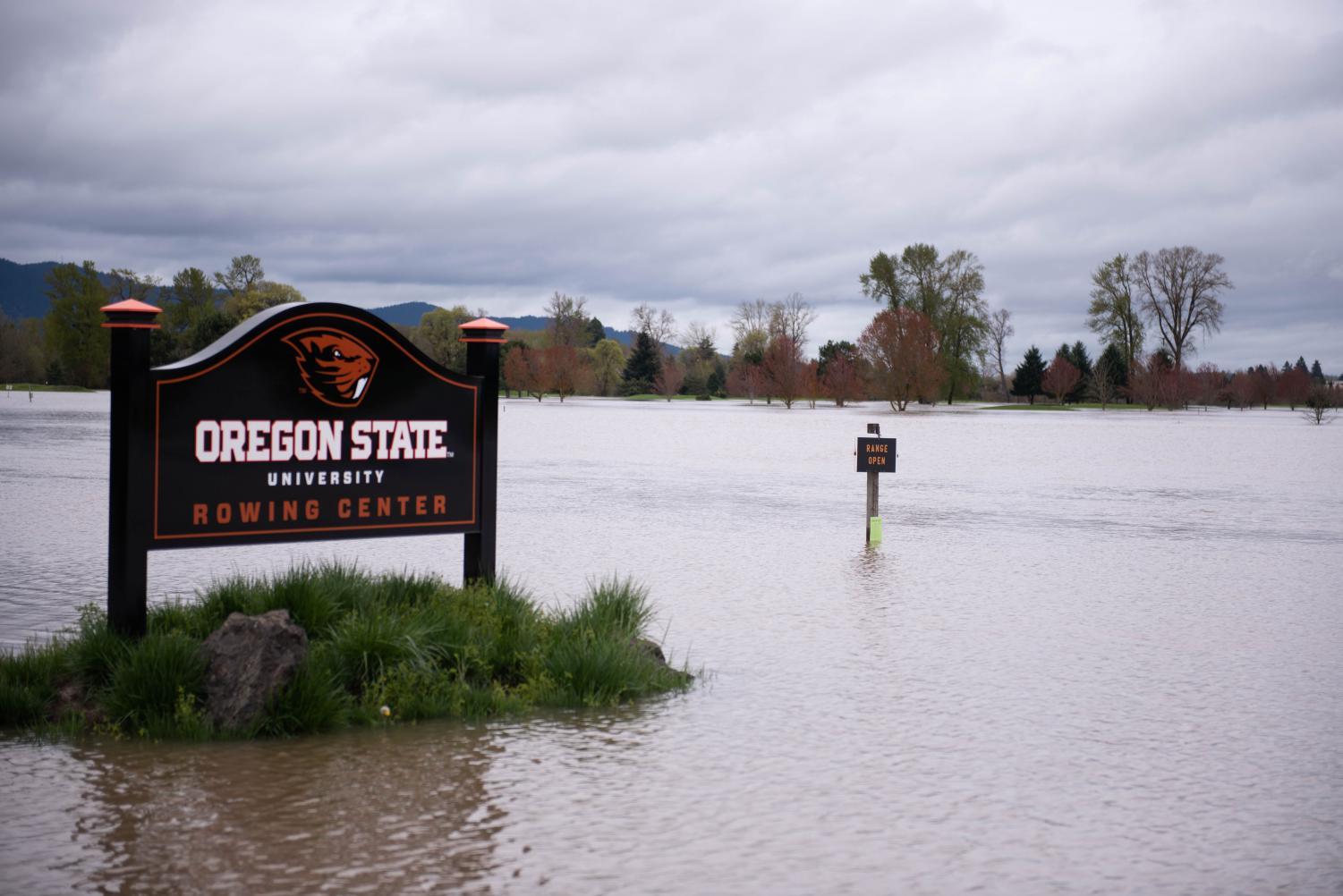
The Trysting Tree Golf Club isn’t usually submerged in water from the Willamette River; nevertheless, boats floated through the club in 1996.
Sean Arey, the general manager of the golf club located in east Corvallis, said the river reached a height of 32 feet on Feb. 10, 1996, leaving about 90% of the course submerged in water.
“They say it was a 100-year flood and we had it twice in one year,” Arey said.
Flooding in Corvallis often results from snowmelt from the Cascades flowing into the Willamette, according to Corvallis Public Works Director Jeff Blaine.
If another 32-foot-high flood like the Trysting Tree flood occurred again in the future, it will likely close Highway 34 and roads east and west off Highway 99, as well as dividing south Corvallis from the north along Southwest Third Street, while phone lines, electricity and most fire stations remained intact according to this government website
Blaine said when planning for floods to “keep in mind that there is a big difference between flood events and rain events, although a rain event can lead to a flood event.” Preparing for rain is different than preparing for floods from the river.
There are also different types of flood events, which can stem from excess rain or water being released from upstream dams on the Willamette, Blaine said.
To predict floods, Arey has his own method.
“If we have a heavy snowfall and an atmospheric river behind it I know we’re going to have water down here within two days, and that’s usually what happens,” Arey said.
Arey thought Corvallis was going to experience flooding again in early December after witnessing snow upstream.
The golf course has survived three large floods at this point, the two in 1996, and one in 2016. There’s an outhouse on the 16th hole with three lines painted where they each reached. Arey says the outhouse has survived all three floods, despite being located in a floodplain.
National Geographic defines a floodplain as a flat stretch of land by a river or stream.
Arey said there was some maintenance and cleanup of debris that floated in, but most of the cost was in lost revenue from being closed. For the flood in February, he estimates the cost to be $5,000 a week, for a total of almost $20,000 in today’s money.
The reason they remained relatively unimpacted is because of the precautions taken back in the 1980s when the course was constructed. The builders knew it was in a floodplain, so they constructed the greens, the course’s most expensive asset, above the highest levels of the plain.
“The golf course was designed to take water and then release water through,” Arey said.
Those types of precautions in floodplain construction have been further mandated by the Federal Emergency Management Agency since Hurricane Katrina, Arey said. He said these precautions help, but the experience of dealing with floods is also very useful.
“We have enough history now to understand what the water’s going to do and where it’s going to go,” Arey said. “We can plan accordingly.”
While the Trysting Tree Golf Club can rely on the topography of their land to direct water through it, the city of Corvallis has to take extra steps to address flooding.
“The piped stormwater system in town has varying degrees of capacity designed to accommodate reasonably anticipatable, more routine, events,” Blaine said. “In many parts of town, capacity would be overwhelmed in an extreme event like a 100-year rain event. You typically wouldn’t build your system to pass such a rare occurrence as it would be cost prohibitive and likely lead to increased maintenance problems, among other challenges.”
The city also creates a flood preparedness brochure that details what to do if homes are impacted by flooding.